Intensified El Niño triggers atypical floods during Florida’s dry months
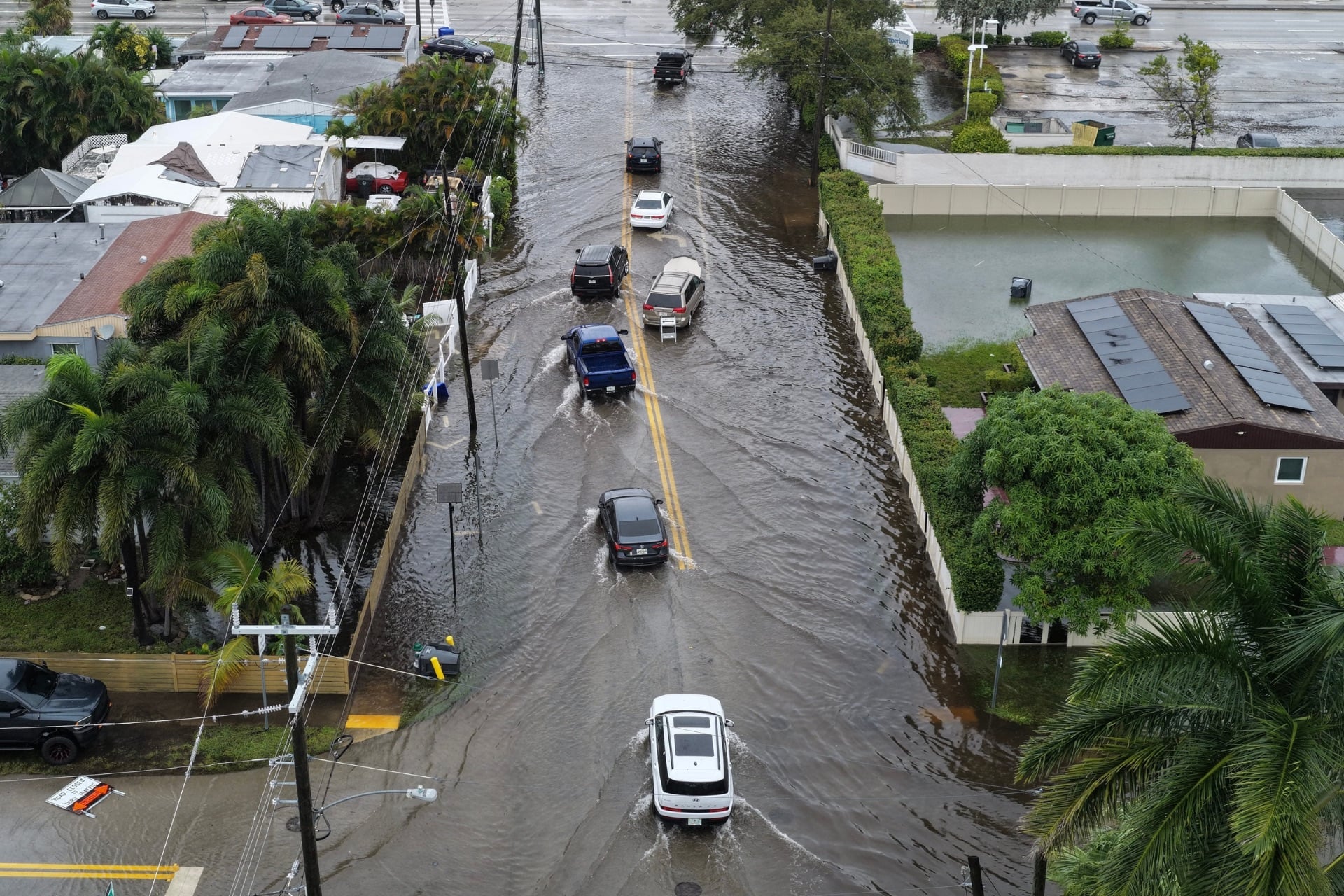
Central Florida is contending with rain intense enough to cause flooding even as the area normally experiences its driest period, a situation officials link to an unusually powerful El Niño that is supercharging a wide‑scale storm system.
El Niño, the cyclical warming of Pacific Ocean waters, has become more pronounced this winter, lifting sea‑surface temperatures well beyond normal levels. The disturbance reshapes atmospheric flow, bolsters the subtropical jet stream and pushes extra moisture toward the southeastern United States. Meteorologists note that the current event ranks among the strongest on record, boosting storm vigor far beyond what the season typically allows.
Rain gauges over the last 48 hours indicate that several central‑Florida counties have recorded three to six inches of precipitation, with isolated river basins exceeding eight inches. The surge has outpaced drainage capacity, leading to road closures, short‑term evacuations of low‑lying neighborhoods and the suspension of classes in affected districts. County emergency managers have issued flash‑flood warnings and are keeping watch on a number of creeks that are nearing critical thresholds.
Florida’s dry season, generally spanning November through April, usually brings modest rainfall and lower humidity, enabling the state’s extensive canal and reservoir network to refill groundwater stores. The abrupt rain influx upsets this balance, raising worries about saturated soils that could threaten agricultural lands, particularly vegetable and citrus crops already strained by earlier drought.
National Oceanic and Atmospheric Administration (NOAA) forecasters anticipate that the amplified El Niño pattern will linger into the spring, heightening the chance of further storm activity across the Gulf Coast and the Atlantic seaboard. Climate scientists warn that, although El Niño’s timing is irregular, its regional weather impacts can be significant, and this year’s “super” phase may set a benchmark for more erratic seasonal shifts.
Local planners are treating the episode as a cue to revisit flood‑risk maps and to prioritize upgrades to storm‑water infrastructure that was designed for a historically drier climate. The unexpected downpour also highlights the larger discussion about how climate variability, including stronger El Niño cycles, may be altering weather expectations in areas once considered temperate.
Residents are urged to monitor local alerts, steer clear of low‑lying roads during heavy rain, and protect their property against possible water damage. As the state navigates this anomalous wet spell, officials emphasize that preparedness and adaptable infrastructure will be essential to lessen both the immediate disruptions and the longer‑term challenges posed by a changing climate.



Comments (0)
Be the first to comment.
Join the discussion